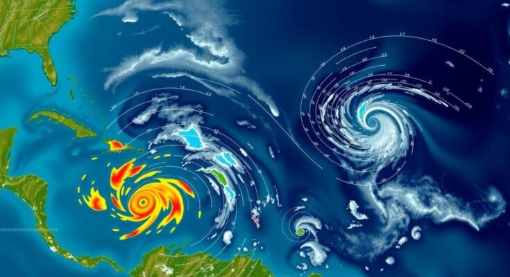
The National Hurricane Center is tracking three disturbances in the Atlantic, with a considerable likelihood (60%) of the southwestern Caribbean low pressure system developing into Tropical Storm Patty over the coming week. Conditions are becoming favorable for tropical development as wind shear diminishes. AccuWeather indicates even higher chances (90%) for development. The potential paths include a swing towards Central America or a risk of impact on the Gulf Coast. Residents in Florida and the Southeast are advised to remain alert as the hurricane season progresses.
The National Hurricane Center (NHC) is currently monitoring three disturbances in the Atlantic, with increasing potential for the development of Tropical Storm Patty. Specifically, there is a 60% chance that a broad low pressure area forming over the southwestern Caribbean Sea could evolve into a tropical depression by the weekend or early next week. In contrast, AccuWeather’s assessment provides a more optimistic 90% chance of development. However, forecasters are uncertain about the intensity and trajectory of this potential storm, with a significant high-pressure system expected over the U.S. East Coast that could influence its path, steering it toward either Central America or possibly impacting the eastern Gulf Coast by the early to mid-November timeframe. Meteorologist Grady Gilman of AccuWeather stated, “Should tropical development occur in the Caribbean Sea next week, there are two scenarios for movement: one toward Central America and another near the Yucatan Peninsula.” While the conditions that gave rise to previous hurricanes Helene and Milton remain in place, high wind shear has previously impeded organization of showers and thunderstorms. This wind shear is expected to decline, allowing for more favorable conditions for tropical development, according to Alex DaSilva, Lead Hurricane Expert at AccuWeather. “Next week, most of the wind shear will shift to the north of the Caribbean, and so it will basically create a pocket with high ocean temperatures, plenty of moisture and very low wind shear that will be favorable for tropical development,” DaSilva explained. The NHC is also tracking two other disturbances; however, these systems show minimal development potential. The first, located in the northeastern Caribbean Sea, is likely to be absorbed by the developing storm in the southwestern Caribbean after causing rainfall over the Dominican Republic, Puerto Rico, and neighboring areas. The second disturbance, situated far in the North Atlantic, presents a limited opportunity for subtropical development as it moves eastward. As the 2024 hurricane season remains active, it is crucial to note that historical data reveal three hurricanes have impacted Florida in November since 1851. As the autumn advances, the risk of tropical development closer to the U.S. intensifies, thereby warranting vigilant monitoring for those in Florida and adjacent regions. In light of the potential for locally heavy rainfall and risks such as mudslides and flash floods, authorities recommend that individuals stay prudent regardless of the likelihood of a tropical storm’s formation. Residents are urged to remain prepared and attentive to updates as the season approaches its end with particular focus on the Caribbean and Southeast U.S. coasts.
The Atlantic hurricane season commences on June 1 and concludes on November 30, featuring repeated occurrences of tropical disturbances. During this period, meteorologists closely monitor environmental conditions that influence the formation and path of tropical systems. The emergence of disturbances during the final month of the season produces unique forecasting challenges due to differing patterns compared to earlier months, where storms predominantly originate from waves off the African coast. The current focus lies in the southwestern Caribbean, where evolving weather patterns suggest a heightened potential for development amid shifting atmospheric conditions, fundamentally influenced by wind shear dynamics and ocean temperatures.
In conclusion, the National Hurricane Center is observing three tropical disturbances, with the southwestern Caribbean Sea system showing significant potential to develop into Tropical Storm Patty. As forecasters project varying paths of potential storm movement, particularly towards Central America or the Gulf Coast, it is imperative for residents in affected areas to stay informed and prepared for any weather developments. Active monitoring and vigilance are crucial as the hurricane season nears its conclusion, with specific emphasis on the potential impacts of these disturbances on the Caribbean and southeastern United States.
Original Source: www.news-journalonline.com


